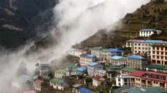
Why is development increasing in high-risk Himalayan zones?
Rapid expansion in tourism, infrastructure, and hydropower is driving human settlement into increasingly dangerous river valleys and glacial corridors. According to a study published in Scientific Reports, the amount of built-up land in high-risk areas across northern Nepal, parts of south-eastern Tibet, and Uttarakhand, India, rose by 45% between 2016 and 2023. The most alarming growth is seen in areas susceptible to flooding from glacial lakes, where development increased by almost 78% during the same period.
This growth is fueled by several economic drivers:
- Tourism Infrastructure: Major hubs like Pokhara have expanded significantly over the last three decades to accommodate rising visitor numbers.
- Hydropower Projects: The regions surrounding the Bhotekoshi and Trishuli rivers have seen a surge in the construction of hydroelectric plants.
- Real Estate and Residential Growth: Increased accessibility along river valleys has encouraged more permanent settlements in low-lying, flat areas.
The study's lead author, University of Leeds glaciologist C. Scott Watson, warns that decisions made regarding development today will dictate the level of disaster risk for decades to come. The researchers noted that their findings likely represent a conservative estimate, as the study focused on specific territories rather than the entire Himalayan range.
How does climate change intensify these natural threats?
The warming of the Himalayan region is occurring at twice the global rate, fundamentally altering the stability of the mountain landscape. This accelerated warming speeds up the melting of glaciers, snowpacks, and permafrost, which in turn destabilizes mountain slopes and increases the volume of water in glacial lakes.
The mechanics of mountain disasters
The interplay between rising temperatures and geography creates several distinct hazards:
- Glacial Lake Outburst Floods (GLOFs): As glaciers melt, they form lakes that can expand until they burst, releasing catastrophic volumes of water downstream. Nepal has recorded roughly 30 such events since 1940.
- Slope Instability: Melting ground and snowpacks can trigger landslides, rockfalls, and ice falls. Furthermore, rising temperatures cause rain to fall at high altitudes where snow was previously the norm, leading to more frequent slope failures.
- Seismic Interaction: The destabilization of mountain slopes by melting ice can be further exacerbated by earthquakes, creating a compounding effect of destruction.
The scale of these events can exceed current risk models. While the study categorized buildings at risk as those within 50 vertical metres of a river or lake surface, residents in the Rasuwa district reported that recent catastrophic flooding saw river levels rise by as much as 70 metres in certain locations, burying even distant structures in debris and sludge.
What is the impact on local communities and economies?
The intersection of rapid development and environmental volatility has left many local residents and business owners in a state of constant insecurity. In Pokhara, a major tourism hub, Mayor Dhana Raj Acharya noted the difficulty of managing risks from the Seti Gandaki River, which flows through the city. Many existing buildings remain just 5 metres from the riverbanks, despite updated regulations intended to increase safety margins.
For those in the trekking regions, the economic consequences are immediate. Phurpa Chhiring Lama, a homestay operator in the Annapurna region, reported a sharp decline in occupancy following recent disasters. Similarly, Krishna Gauchan, whose hotel is located near the glacier-fed Modi river, expressed the constant fear felt by those living near potential glacial collapse sites.
The broader economic implications for nations like Nepal are profound. During a recent UN General Assembly speech, Nepal's Prime Minister Balendra Shah highlighted that the country is paying a "colossal price" for a climate crisis it did not cause. He noted that every major disaster threatens to reverse years of developmental progress and forces developing nations to incur debt to repair damage caused by global warming.
Why are building regulations struggling to mitigate risk?
A significant gap exists between official zoning laws and the reality of construction on the ground. In many parts of the Himalayas, economic growth and the desire for accessible land have led to the bypassing of environmental safeguards.
Urban planning experts, such as Professor Surya Raj Acharya from the University of Nepal, point out that roads, hotels, and markets are frequently built on the low, flat land along riverbanks because it is the most buildable terrain. He argues that while the fragile Himalayan ecosystem requires stricter enforcement of building codes, these rules have historically been weak or poorly implemented.
Regional regulatory responses
Different regions are attempting to address these vulnerabilities with varying degrees of success:
- Nepal: The national disaster agency has announced plans to ban settlements within 15 metres of riverbanks along the recently devastated Rasuwa-Bhotekoshi corridor.
- India (Uttarakhand): On 12 October, the Uttarakhand government approved new floodplain zoning rules designed to protect infrastructure while maintaining natural water flows. However, activists like Anoop Nautiyal argue that construction continues to occur rampantly despite existing rules.
- Proposed Solutions: Basanta Raj Adhikari of Tribhuvan University suggested that insurance-based mitigation could be effective. By mapping areas as high, moderate, or low risk, insurance providers could offer better coverage to those building in safer zones, thereby incentivizing safer development patterns.
FAQ: Himalayan disaster risks
How many people are currently at risk in the Himalayas?
A recent study suggests that at least 300,000 people in parts of northern Nepal, south-eastern Tibet, and Uttarakhand, India, are living in high-risk zones. The researchers believe the actual number could be much higher as the study only covered specific territories.
What is the primary driver of increased flooding in this region?
The primary driver is the rapid melting of glaciers due to warming in the Himalayas, which is occurring at twice the global average rate. This process fills glacial lakes, increasing the risk of sudden and devastating glacial lake outburst floods (GLOFs).
How much has development increased in these dangerous areas?
Built-up land in high-risk zones grew by approximately 45% between 2016 and 2023. In areas specifically threatened by glacial lake flooding, the increase in development was even more significant, rising by nearly 78% during that same period.
Why are buildings being constructed so close to riverbanks?
Construction often occurs near riverbanks because the low, flat land along river valleys is the most accessible and easiest to build on. This has led to the expansion of tourism facilities, hydropower plants, and residential real estate in vulnerable corridors.
Can new regulations stop these disasters?
While new zoning rules are being introduced in Nepal and India, experts warn that enforcement remains a major challenge. Effective mitigation requires not just new laws, but strict implementation and potentially new economic tools like risk-based insurance grading.
Key takeaways
- Built-up land in high-risk Himalayan zones increased by 45% between 2016 and 2023.
- Development in areas prone to glacial lake flooding rose by nearly 78% in the same period.
- Himalayan warming is occurring at twice the global average rate, accelerating glacier melt.
- At least 300,000 people are currently identified as living in potential disaster paths.
Conclusion
The rapid expansion of human activity in the Himalayan region has created a precarious situation where economic development directly clashes with increasing environmental volatility. As tourism, hydropower, and residential construction push deeper into river valleys, the vulnerability of hundreds of thousands of people grows. While governments in Nepal and India are attempting to implement stricter zoning and floodplain regulations, the challenge of enforcement and the sheer pace of climate-driven changes remain significant. Addressing these risks will require a combination of improved early-warning systems, stricter land-use planning, and international cooperation to manage the disproportionate impact of global warming on these fragile mountain ecosystems.